Trail  Le Dévoluy - 2023-10-04_21h28m07_le-grand-ferrand-par-la-voie-normale - Photo

2023-10-04_21h28m07_le-grand-ferrand-par-la-voie-normale

 okfred26
okfred26

User

© OpenStreetMap contributors
Length
Length
16 km
Max alt
Max alt
2744 m
Uphill gradient
Uphill gradient
1390 m
Km-Effort
Km-Effort  
35 km
Min alt
Min alt
1444 m
Downhill gradient
Downhill gradient
1392 m
Boucle
Boucle
Yes
Creation date :
2023-10-04 19:28:08.083
Updated on :
2023-10-04 19:28:09.929

(0 Reviews)


Scan this QR Code to open this trail in the SityTrail application

FREE GPS app for hiking

Logo SityTrail SityTrail

IGN / Geographical institutes

Download SityTrail from the App Store Download SityTrail from Google Play

Logo SityTrail SityTrail World

The world is yours!

Download SityTrail from the App Store Download SityTrail from Google Play Download SityTrail on Huawei AppGallery

About

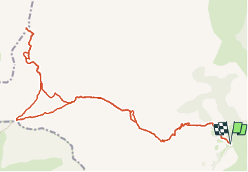
Trail of 16 km to be discovered at Provence-Alpes-Côte d'Azur, Hautes-Alpes, Le Dévoluy. This trail is proposed by okfred26.

Description

Au départ de la piste de Maubourg suivre le GR jusqu'au col de Charnier puis prendre une sente à peine marquée direction Nord jusqu'à la terrasse des reflexions ensuite monter le pierrier puis la cheminée ( suivre les traces rouges à peine visibles ) jusqu'au sommet

Elevation profile

Positioning

Country:
France
Region :
Provence-Alpes-Côte d'Azur
Department/Province :
Hautes-Alpes
Municipality :
Le Dévoluy
Location:
Agnières-en-Dévoluy
Start:(Dec)
Start:(UTM)
727029 ; 4953773 (31T) N.

Trails nearby

Trail Walking Le Dévoluy - R12   Le Col des Aiguilles - Photo
Walking
GUIDE+

Walking

Medium
(1)
Le Dévoluy, Provence-Alpes-Côte d'Azur, Hautes-Alpes, France
10.2 km | 19.2 km-effort
3h 56min
Yes
Trail Walking Le Dévoluy - R11   Cabane Rama - Photo
Walking
GUIDE+

Walking

Very easy
(4)
Le Dévoluy, Provence-Alpes-Côte d'Azur, Hautes-Alpes, France
5.5 km | 8.4 km-effort
1h 46min
Yes
Trail Walking Le Dévoluy - Cascade de Saute Aure - Photo
Walking
marmotte83

Walking

Easy
(3)
Le Dévoluy, Provence-Alpes-Côte d'Azur, Hautes-Alpes, France
7.7 km | 10.8 km-effort
3h 1min
Yes
Trail Walking Le Dévoluy - Tour du Dévoluy - Superdévoluy à Lachaup - Photo
Walking
tracegps

Walking

Medium
(1)
Le Dévoluy, Provence-Alpes-Côte d'Azur, Hautes-Alpes, France
8.3 km | 12.5 km-effort
3h 0min
No
Trail Walking Le Dévoluy - Pierre Baudinard - Photo
Walking
GUIDE
Marco05

Walking

Difficult
Le Dévoluy, Provence-Alpes-Côte d'Azur, Hautes-Alpes, France
11 km | 19.6 km-effort
4h 27min
Yes
Trail Walking Le Dévoluy - Col des Aiguilles - Photo
Walking
GUIDE
Marco05

Walking

Difficult
Le Dévoluy, Provence-Alpes-Côte d'Azur, Hautes-Alpes, France
11.3 km | 21 km-effort
4h 46min
Yes
Trail Walking Le Dévoluy - Cabane de la Rama - Photo
Walking
GUIDE
Marco05

Walking

Easy
Le Dévoluy, Provence-Alpes-Côte d'Azur, Hautes-Alpes, France
5.8 km | 8.6 km-effort
1h 56min
Yes
Trail Touring skiing Le Dévoluy - L'Aiglière et serre de cheval - Photo
Touring skiing
GUIDE
nadd73

Touring skiing

Medium
Le Dévoluy, Provence-Alpes-Côte d'Azur, Hautes-Alpes, France
10.9 km | 26 km-effort
6h 10min
Yes
Trail Touring skiing Le Dévoluy - col sou la tête d'oriol et crête de la clape - Photo
Touring skiing
GUIDE
nadd73

Touring skiing

Medium
Le Dévoluy, Provence-Alpes-Côte d'Azur, Hautes-Alpes, France
14.6 km | 31 km-effort
6h 9min
Yes


Close
My subscriptions